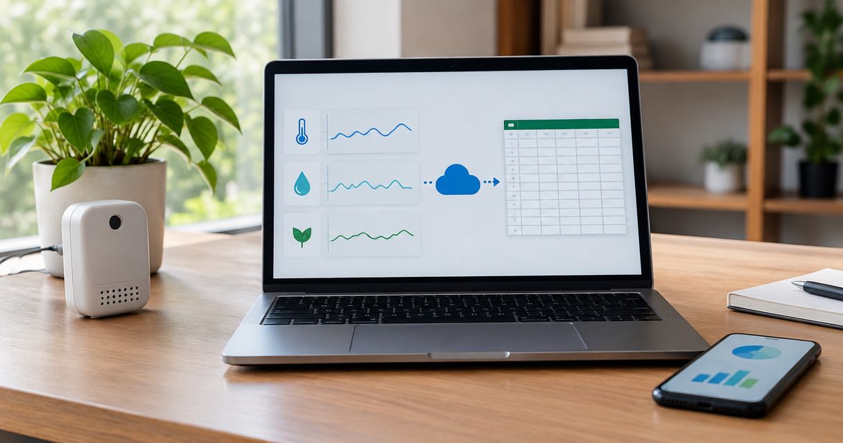
Yes—you can track equipment location with LoRaWAN instead of GPS when you need site or zone visibility and have a suitable positioning method behind it. LoRaWAN carries data; GPS determines position, so removing GPS means replacing the source of location, not simply changing the radio. An IoT platform can organize the resulting device data, but it cannot turn an ordinary LoRaWAN transmission into an accurate location by itself.
- To track equipment location, LoRaWAN instead of GPS works when a suitable non-GPS positioning method meets your needs.
- Gateway reception indicates connectivity, not necessarily the equipment’s nearest gateway or exact position.
- Bluetooth zone detection and network geolocation require different hardware, infrastructure and validation.
- Kilo provides the IoT platform layer; positioning still depends on compatible hardware and integrations.
Can you track equipment location with LoRaWAN instead of GPS?
Yes, but the answer depends on what you mean by location. Knowing that a generator was recently heard at a depot is different from finding a tool in a particular workshop or following equipment between job sites.
Several architectures can answer those questions. They do not provide interchangeable evidence, and some still use GPS even though their communications run over LoRaWAN.
| Architecture | What establishes location | Best for | Main advantage | Main limitation |
|---|---|---|---|---|
| Gateway presence | Reception by infrastructure associated with a known site | Broad site visibility | Uses reception information rather than satellite positioning | Radio coverage overlaps; reception does not prove a precise zone |
| Network geolocation using TDoA | Differences in reception time across synchronized gateways | Network-derived location estimates | Does not require a GPS fix on the tag | Requires suitable gateway coverage, timing and a geolocation service |
| Bluetooth-assisted LoRaWAN tracking | Detection of known Bluetooth beacons or tags | Defined indoor zones | Associates observations with mapped areas | Requires Bluetooth infrastructure and compatible tracking hardware |
| GPS/GNSS tracker using LoRaWAN | Satellite-derived coordinates sent over LoRaWAN | Outdoor equipment within network coverage | Separates positioning from data transmission | Still needs satellite reception and LoRaWAN connectivity |
GPS is one global navigation satellite system, or GNSS. A tracker described as GNSS-enabled can use satellite positioning while sending its readings through LoRaWAN; that is not GPS-free tracking.
Decide whether you need a site, a zone or coordinates
Start with the question someone must answer when equipment goes missing. The required decision determines the architecture more reliably than a radio specification.
For depot inventory, the useful question might be whether an asset has recently communicated through the depot’s network. For maintenance, it might be which workshop contains it. For equipment moving between properties, you might need coordinates and a communications service that follows the journey.
Write that requirement in operational language: “A technician should be able to find the equipment without searching unrelated buildings.” Then specify what evidence qualifies as success. A colored marker on a map is not enough if nobody knows how the marker was calculated.
Separate location accuracy from location freshness. A correct position from an earlier report does not establish where moving equipment is now. Your interface should make the observation time visible beside the location, not leave readers to assume that every displayed position is current.
Gateway presence: useful for visibility, weak for precise location
A LoRaWAN gateway receives radio messages and forwards them into the network. If you know where the receiving infrastructure sits, its reception metadata can support a broad statement about where an asset was heard.
That statement needs careful wording. “Heard by the depot gateway” is an observation; “inside the depot” is an inference.
A gateway can receive messages from outside the boundary you care about. Metal structures, antenna placement, reflections and obstructions also affect signal strength, so the strongest reception does not reliably identify the nearest gateway.
Best for: broad site visibility where approximate presence is useful. Gateway presence is a practical starting point for inventory checks, but it is a poor substitute for validated room-level positioning.
If your application assigns sites from gateway reception, test the boundary deliberately. Walk the tagged equipment outside the property and into neighboring areas. Record where the system continues to label it as present before you use that label to trigger an operational decision.
TDoA geolocation: location from network timing
Time Difference of Arrival, usually shortened to TDoA, estimates position from differences in when gateways receive the same transmission. It needs reception by multiple suitably synchronized gateways and a service that calculates the estimate.
This is not a feature you get merely by installing an ordinary gateway. Gateway timing capabilities, deployment geometry and the geolocation service all matter.
The benefit is that the tag does not need to obtain a satellite fix for that positioning method. The limitation is that the network must supply the observations required to estimate its location. A network that successfully delivers sensor messages is not automatically a network that supports useful geolocation.
Best for: deployments with suitable timing infrastructure and a validated network-geolocation service. Ask the provider to demonstrate performance over your actual operating area, including its boundaries and obstructed sections. Do not apply an accuracy figure from an open test field to an equipment yard without testing it there.
Bluetooth-assisted tracking: location from known zones
Bluetooth-assisted designs use local radio observations to associate equipment with a known place. One arrangement has a mobile tracker scan fixed Bluetooth beacons and send the observations through LoRaWAN. Another has fixed readers observe mobile Bluetooth tags; its communications architecture depends on the reader.
Those arrangements are not interchangeable. Confirm which component scans, which component transmits and where observations become a zone assignment.
For example, a configured system could associate a beacon identifier with a workshop. A compatible tracker reports that identifier, and the application interprets the observation using the configured mapping. This is an illustrative architecture, not a claim that every Bluetooth tracker supports that workflow.
Best for: defined indoor areas where a zone label answers the search question. The advantage is meaningful indoor context without relying on satellite reception. The trade-off is maintaining beacon or reader placement, mappings and hardware alongside the tracked assets.
Radio signals cross doorways and partitions. Validate adjacent zones rather than assuming that installing a beacon in a room creates a clean electronic boundary around it.
GPS over LoRaWAN: keep positioning and transport separate
A GPS-enabled LoRaWAN tracker obtains coordinates from satellite signals, then sends them through the LoRaWAN network. This architecture uses both technologies because they solve different problems.
It is useful when equipment operates outdoors within suitable LoRaWAN coverage. It does not solve every indoor positioning problem, and the tracker still needs a way to report its data wherever the equipment travels.
Best for: outdoor coordinates within a known communications footprint. Its advantage is an explicit coordinate source; its limitation is dependence on both positioning conditions and network coverage.
For travel beyond that footprint, evaluate the communications path separately. A tracker can obtain a valid position without being able to deliver it to your application. Conversely, it can communicate successfully while failing to obtain a fresh satellite fix.
Keep those failure states distinct in the data model. “No new coordinates” and “no recent message” require different investigations.
Why LoRaWAN tracking performance varies
The useful result depends on the complete system, not just the tag’s radio. These factors change what you can conclude from a location report:
- Positioning method: Gateway presence, timing-based geolocation, Bluetooth observations and satellite coordinates establish different kinds of evidence.
- Infrastructure placement: Gateway geometry and beacon or reader positions affect which observations the system receives.
- Physical environment: Buildings, metal equipment, containers and obstructions influence radio propagation and satellite reception.
- Reporting behavior: Movement triggers and periodic reporting determine how quickly a changed location reaches the application.
- Installation: Mounting position and antenna exposure affect communication; test the tag attached to the actual equipment.
- Data interpretation: Identifier mappings, timestamps and stale-data handling determine whether a useful observation becomes a misleading display.
Battery performance belongs in this assessment too. Position acquisition, scanning, transmissions and reporting settings all consume energy. Removing GPS does not establish a battery-life figure; compare the complete operating profiles under the conditions you intend to use.
How to test a GPS-free equipment-tracking workflow
Test the decision you want the system to support, not just whether packets arrive. Use representative equipment and include locations where the proposed method is most likely to fail.
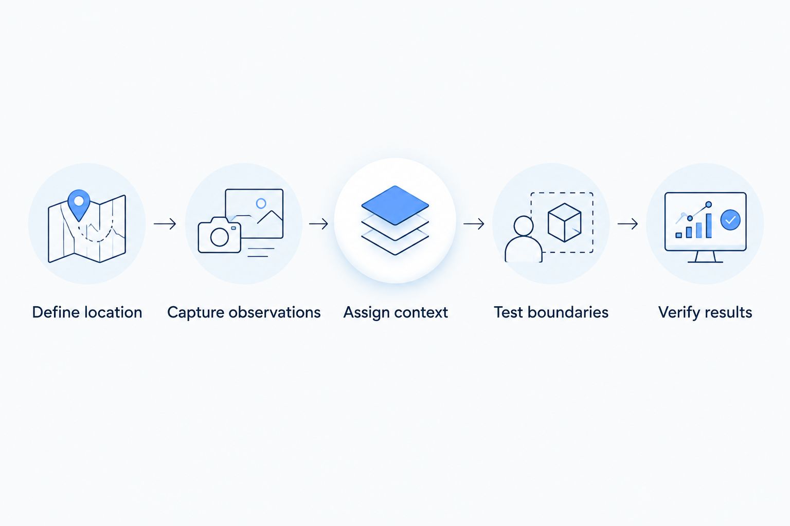
- Define location. Specify whether success means identifying the site, selecting a zone or estimating coordinates. State who uses the result and what they do next.
- Capture observations. Record the underlying evidence: receiving gateways, timing-derived estimates or Bluetooth identifiers. Preserve the observation time where the integration provides it.
- Assign context. Map identifiers and estimates to equipment records and meaningful places. Keep an inferred zone distinguishable from a measured coordinate.
- Test boundaries. Move equipment between neighboring zones, behind obstructions and beyond network coverage. Compare the reported result with its known position.
- Verify results. Check whether the responsible person can find the equipment, recognize stale information and distinguish an uncertain location from a confirmed observation.
The workflow should retain uncertainty rather than hiding it. If evidence does not support a room assignment, display an unknown or broader location instead of presenting an exact-looking answer.
Repeat the test after changing infrastructure placement or equipment mounting. Those changes can alter the observations on which your location assignments depend, even when the application configuration stays the same.
Where the IoT platform fits in equipment tracking
The Kilo IoT Platform brings device data, digital records, dashboards, automation and alarms into a shared software layer. For equipment tracking, the starting requirement is a supported integration that supplies usable observations and maps them to the correct asset.
Kilo fits integrators who need an IoT platform to combine equipment observations with monitoring and response workflows. It does not replace the positioning hardware or establish that an arbitrary tracker’s location features are supported.
An illustrative deployment would ingest an equipment identifier, a location observation and its timestamp. You would associate that information with the asset, present the relevant context and define who investigates missing or outdated reports. The exact configuration depends on the supported device payload and integration.
Hardware sourcing remains separate from platform software. Kilo Electronics is a separate online authorised dealer for compatible hardware, serving individual and business buyers; a hardware purchase does not by itself establish compatibility with your proposed positioning workflow.
Can equipment still be tracked after it leaves the site?
Only if the system retains a suitable positioning method and a communications path beyond the site. Private LoRaWAN coverage does not automatically follow equipment onto the road or into another facility.
For equipment moving across properties, consider the wider architecture described in cellular IoT connectivity for mobile asset tracking. Choose communications coverage and positioning independently, then validate them together.
Does a missing LoRaWAN report mean equipment was stolen?
No—a missing report establishes a communications gap, not theft. Battery depletion, obstruction, gateway or backhaul problems, and movement outside coverage can produce the same symptom.
Treat missing reports as a reason to investigate. The response should depend on the last reliable observation and the equipment’s operational importance, not an unsupported conclusion about what happened.
FAQ
Can a LoRaWAN tag work without a GPS receiver?
Yes, a LoRaWAN tag can communicate without a GPS receiver. To locate equipment, the wider system still needs a method such as gateway-based presence, network geolocation or Bluetooth-assisted positioning.
Will adding a gateway tell me which room contains a tool?
Adding a gateway does not establish room-level location. Gateway radio coverage does not follow room boundaries, so room identification needs a suitable positioning design and on-site validation.
Is Bluetooth-assisted tracking the same as Bluetooth mesh?
No, Bluetooth-assisted location does not inherently require Bluetooth mesh. Beacon scanning and tag-reader observations describe positioning arrangements, while mesh describes a networking approach.
Can I put a LoRaWAN tracker inside a metal equipment cabinet?
A metal cabinet can obstruct radio communication and satellite reception. Test the intended mounting position on the equipment rather than relying on a successful test with the tracker held outside it.
Should a dashboard show the last known location as current?
A dashboard should distinguish the last known location from a current observation. Display the observation time and make stale information recognizable so users do not treat an old position as proof of present location.
Does GPS-free tracking always use less battery power?
GPS-free tracking does not guarantee lower power consumption. Scanning behavior, reporting frequency, radio conditions and the positioning architecture determine the complete energy requirement.
Make unknown location a usable result
A tracking system should be allowed to say it does not know. That answer is more useful than a precise-looking map pin derived from weak or outdated evidence.
Before choosing hardware, decide how your application will represent a fresh observation, an inferred zone and a stale location. Then test whether the person looking for equipment understands the difference. That is the point where a tracking demonstration becomes a useful operational tool.
Written by Tim Kravchunovsky